Rud Platt
Professor, Environmental Studies
Director, GIS lab
Gettysburg College, Pennsylvania
In Person:
GUGG 205
Mar 3, 2023, 3:35 PM - 5:00 PM
Or Join Zoom Meeting:
Zoom login required (free account available at zoom.us)
Abstract
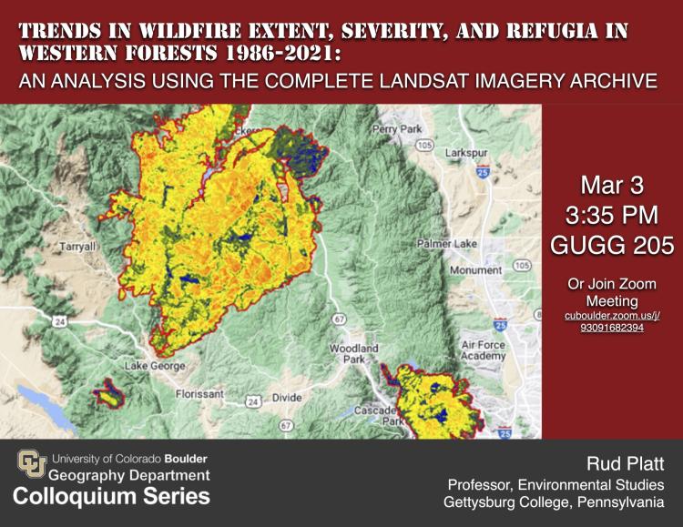
In the western USA, fire frequency/extent have increased due to climate change, fire suppression, and increased ignitions. However, evidence is less conclusive about changes to the severity and completeness of burning. Most fire perimeters contain fire refugia, islands of unburned or less impacted areas within a fire perimeter that act as seed sources. Using Google’s Earth Engine image processing and analysis platform, we processed all available Landsat imagery to identify refugia within the perimeters of large wildfires (405 ha+) in 16 forested ecoregions of the western United States. Associated characteristics (i.e. fire severity, fire weather, pre-fire vegetation, and topography) were also calculated. We asked (1) How have forest fires changed 1986-2021 in terms of frequency, burned area (ex. refugia), and time of year? (2) How have fire refugia changed and what biophysical factors are associated with fire refugia? Consistent with other studies, we found that forest fires have become more frequent and occur earlier in the year and at higher elevation on average. After removing refugia, we found that burned area has increased overall and per fire. Using a variety of statistical and machine learning techniques, we found that the percent of refugia and fire severity have changed in specific ecoregions but not across western forests as a whole. The strongest predictors of percent refugia are related to fire severity and burned area in non-refugia. Overall, we found that trends in refugia, fire severity, and associated factors are highly specific to ecoregions.
Bio:
Rud Platt is a professor of environmental studies and director of the GIS lab at Gettysburg College in Pennsylvania, where he teaches courses in remote sensing, GIS, and environmental science. Rud’s research broadly relates to land systems science, the study of land cover and land use as a coupled human-environment system. He is particularly interested in the dynamics of the Earth’s wildland-urban interface (WUI), including the relationships between wildfire hazard, forest management, land use change, and climate change. His study areas are situated within the Rocky Mountain West, the Marcellus Shale Region of Pennsylvania, and the Terai Arc Landscape of India. Rud received his Ph.D. Geography from CU Boulder in 2004 and is currently a visiting scholar at the CIRES Earth Lab.